Cartografia
A sua pesquisa devolveu 4 Resultados
-
Ordenar por : Publicação na BND
-
Resultados por página : 10
-
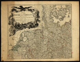
Map of the empire of Germany including all the states comprehended under that name with the kingdom ...
Map of the empire of Germany including all the states comprehended under that name with the kingdom ...
| Autor | Delarochete, Louis Stanislas dªArcy, 1731-1802 |
| Nome do Editor | Robert Sayer |
| Língua | Inglês |
| Data de publicação | [ca 1785] |
| País | Reino Unido |
-
A chart of the coasts of Spain and Portugal with the Balearie Islands and part of the coast of Barba...
A chart of the coasts of Spain and Portugal with the Balearie Islands and part of the coast of Barba...
| Autor | Delarochete, Louis Stanislas dªArcy, 1731-1802 |
| Nome do Editor | William Faden |
| Língua | Inglês |
| Data de publicação | August 30th 1779 |
| País | Reino Unido |
-
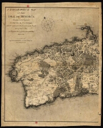
A topographical map of the isle of Minorca
A topographical map of the isle of Minorca
| Autor | Delarochete, Louis Stanislas dªArcy, 1731-1802 |
| Nome do Editor | William Faden |
| Língua | Inglês |
| Data de publicação | 1st Jan[uar]y, 1780 |
| País | Reino Unido |
-
Colombia Prima or South America, in which it has been attempted to delineate the extent of our knowl...
Colombia Prima or South America, in which it has been attempted to delineate the extent of our knowl...
| Autor | Delarochete, Louis Stanislas dªArcy, 1731-1802 |
| Nome do Editor | Published by William Faden, Geographer to His Magesty and to His Royal Highness the Prince of Wales |
| Língua | Inglês |
| Data de publicação | 1807 |
| País | Reino Unido |